

Download & Print
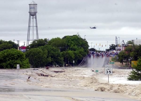
The City of Bandera during the 2015 flood.
Courtesy Image
March 4, 2020
Interactive Flood Risk Management system in place
By Jessica Nohealapa'ahi Goode
The Bandera Prophet
In partnership with Bandera County Commissioners’ Court, the U.S. Geological Survey, the Texas Water Development Board, the City of Bandera and the Economic Development Corporation, the Bandera County River Authority and Groundwater District introduced InFRM - pronounced ‘in-firm’ - an Interactive Flood Risk Management system.
The flood early-warning study system is based on non-political non-biased science, USGS Hydrologist Namgeong Choi said. Stream gages are installed at the county’s North Prong at Brewington Creek, Patterson Road, the West Prong at Carpenter Creek Road, and at Bandera River and English Crossing. They all calculate water flow in real time, which helps emergency planners estimate when potential floodwaters will arrive downstream.
Dry creek beds become super highways for water flow, which can move as fast as 46,700 cubic feet per second - the amount recorded during Bandera County’s 1978 flood when 48 inches of water fell in 72 hours. For perspective, one cubic foot of water is equivalent to a basketball - that’s 46,700 basketballs going by every second.
“Data can tell a lot of stories,” Choi said, adding in order to create the flood inundation map, she had to produce a model (solving energy and momentum equations) that tells the velocity of each cross section. “Once you know the distance between them and velocity of flow, you can see how fast water flows.”
In other words, the InFRM model shows how long it will take for a flood wave to move from one point to another.
The higher the stage is, the faster the flood wave travels, Choi said, so it’s possible to calculate the difference in arrival time between two peaks. Action stages include 10 feet, 13 feet - flood stage, 14 feet - moderate flood stage, 24 feet - major flood stage, and 38 feet - the maximum peak ever recorded.
Emergency Management Coordinator Carey Reed said she constantly monitors the sites.
“If one of these gages go up, I call USGS and they check it out. There is a lot of good, but there’s also a lot of “don’t panic” situations. Sometimes there are glitches,” Reed said. “If you have a question, call us. We verify everything we see. If we have to evacuate, will send out emergency notifications, post on Facebook and send people out door to door. Please feel free to call us before you put it up on Bandera County Chat and scare everyone.”
Reed said the county’s emergency management department determines when it’s time to evacuate during a flood event.
“When it hits 10 [feet], we start calling all the RV parks along the river. At 11, it’s going to start coming up to the lower level of Pioneer RV,” Reed said, adding RV owners are advised at this stage to roll up awnings and pull in extensions. “We know at 13 feet, Pioneer RV does not flood, but will be notified.”
Reed further said her department has a lot of experience dealing with floods, and weather spotters are in place at the county’s north and west prongs.
“We’re not going to panic you if it’s going to reach 10 but not 13,” Reed said. “[County Judge Richard Evans] has been here over 70 years. He knows every inch of this county. If it rains an inch at one spot, he knows how it will affect another. You can’t buy this knowledge. There’s no accounting for experience.”
To see real-time stream gage data, go to https://waterdata.usgs.gov/nwis.
To manipulate the InFRM model, go to https://wimcloud.usgs.gov/apps/FIM/FloodInundationMapper.html
To sign up for alerts, to to https://water.usgs.gov/wateralert/